Macetown: a gold-rush ghost town reached by 25 river crossings
How do you get to Macetown and how many river crossings are there?
Macetown sits at the end of a 4WD track that fords the Arrow River around 25 times over roughly 15 kilometres from Arrowtown. Most visitors go with a guided 4WD tour; a few self-drive in a genuine off-road vehicle, mountain bike, or walk. The fords are impassable after heavy rain, and rental car contracts exclude the road entirely.
A ghost town at the end of the Arrow River
Macetown isn’t a stop you pass on the way to somewhere else. It’s the destination itself: a scattering of stone chimneys, building foundations and old orchard trees at the head of a narrow gully above the Arrow River, reachable only by a 4WD track that fords the river roughly 25 times. There’s no bridge over most of those crossings, no sealed surface for any of the 15 kilometres from Arrowtown, and no mobile signal once you’re in the gorge. That’s the whole appeal. This was one of the richest gold workings in Central Otago in the 1860s, and because it was hard to get to then and is still hard to get to now, it was never bulldozed, built over or turned into a car park.
Most people see it on a guided 4WD tour, and for good reason: the crossings genuinely require a proper off-road vehicle and local knowledge of the riverbed, and a rental car contract in Queenstown will not cover you here regardless of how capable your car looks.
The 1862 gold rush, briefly
Gold was found in the Arrow River gully in 1862, in the same wave of discoveries that put Arrowtown on the map. Prospectors worked their way upstream from the main river, and by the mid-1860s a settlement had formed at the gully head that became known as Macetown, named after an early miner. At its peak the town supported something close to 1,500 people at a time — sluicing crews, storekeepers, a school, hotels — squeezed into a valley that today feels almost too narrow for a single 4WD track.
The easy alluvial gold didn’t last. As the gully was worked out through the 1870s and 1880s, the population thinned to a handful of families running small operations and grazing sheep on the surrounding hills. A few residents held on for decades after the rush proper had ended, farming and prospecting in a town that was already emptying around them, until the last permanent household eventually left and the buildings were abandoned to the weather. What’s left standing today — stone foundations, a couple of chimneys, remnant fruit trees planted by residents generations ago — survived largely because nobody had a reason to come back and clear it.
This is a genuinely different kind of gold-rush site to Arrowtown itself. Arrowtown’s Chinese Settlement and Buckingham Street survived because the town kept living around them. Macetown survived because the town didn’t.
Getting there: the 25 fords
The road out of Arrowtown follows the Arrow River gorge, narrowing after the first few kilometres from a rough gravel track to something that spends as much time in the riverbed as beside it. Depending on the season and how the river has reshaped its bed since the last big flow, you’ll cross the Arrow somewhere around 25 times over the final stretch to the site. None of the crossings are bridged; the vehicle drives through the water itself, and depths vary from a wet tyre to axle-deep depending on rainfall and the time of year.
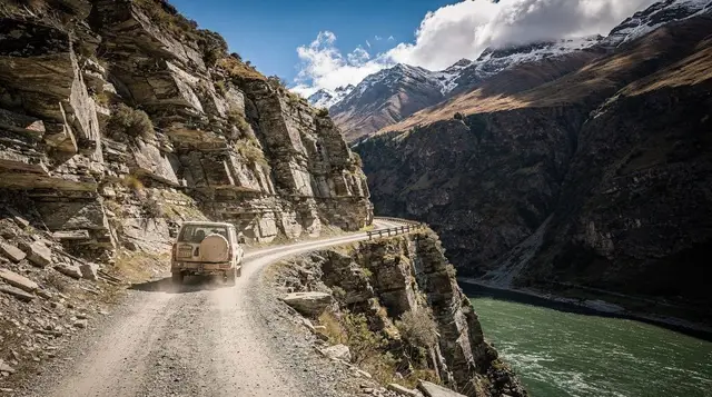
This is the same broad terrain as Skippers Canyon — narrow, unforgiving, and built for a specific kind of vehicle rather than an ordinary car — and it’s treated the same way by every rental company operating out of Queenstown and Arrowtown. Macetown and Skippers Canyon are named exclusions on standard rental agreements: drive either road in a hire car and your insurance is void, crossing or no crossing, damage or no damage. If you want to see driving in New Zealand’s South Island in its rawest form, this is it, but it’s not a route to attempt in whatever you picked up at the car rental counter.
The realistic ways to see it
| Option | What it involves | Best for |
|---|---|---|
| Guided 4WD tour | Driven by a local guide who knows the current line through each ford | Anyone without their own genuine off-road vehicle; most visitors |
| Self-drive 4WD | Your own or a specialist 4WD rental, driven by you | Experienced off-road drivers only, and only in settled conditions |
| Mountain bike | Ride the same track and fords under your own power | Fit, confident cyclists comfortable getting wet |
| On foot | A long day walk following the 4WD track | Well-prepared walkers with a full day and good weather |
For most people the guided option is the only one worth weighing up seriously, and it removes the two biggest variables — reading the river and navigating the track — from a day where the weather can already throw enough at you.
The guided 4WD tour
The Macetown Gold Heritage 4WD full-day tour runs from Queenstown, picking up en route through Arrowtown before dropping into the gorge. A guide drives; you sit back and watch each crossing come up rather than reading the riverbed yourself, which on a route with this many fords is worth more than it sounds. Commentary along the way covers the 1862 rush, what happened to the town after the gold ran out, and what you’re looking at once you reach the site — the difference between a genuine 1860s foundation and a later addition isn’t always obvious without someone pointing it out.
At Macetown itself, tours typically build in time to walk around the remaining structures and try gold panning in the river, with equipment supplied. Don’t go in expecting to find anything life-changing in the pan — the accessible gold was worked out well over a century ago — but a few flecks of colour are common enough to make it worth the ten minutes.
A full return trip, including the transfer from Queenstown, runs to a full day: six to seven hours is typical once you count the drive to Arrowtown, the crossings in both directions, and time on site. It’s not a half-day add-on to another activity.
Skippers Canyon as a comparison
If you’re deciding between Macetown and the other big Arrow-district 4WD trip, it’s worth knowing they’re different experiences built around the same constraint. The Skippers Canyon 4WD gold heritage tour follows the Shotover River gorge instead of the Arrow, with a narrow cliff-edge road, the historic Skippers Bridge, and its own gold-rush settlements and cemetery.
It has far fewer river crossings but more exposure along sheer drop-offs; Macetown has more crossings and a gentler road once you’re past the ford count. Neither is a lesser version of the other — they’re companion trips covering two separate rush-era valleys, and doing both across a longer Queenstown stay isn’t unreasonable if 4WD heritage touring is the point of your visit.
Why the fords close the road
The single biggest thing to understand about Macetown, more than the history or the scenery, is that the road is genuinely closed to it some of the time — not theoretically, but in practice, on a fairly regular basis. The Arrow River responds fast to rain in the hills above the gorge. A crossing that’s a wet tyre in the morning can be a real ford by afternoon after rain further upstream, even if it’s dry where you’re standing. Guides make the call on the day, and a tour is cancelled or turned back rather than pushed through a crossing that’s running high — this isn’t a soft caution added for liability, it’s how these tours actually operate.
If Macetown is a fixed point in your itinerary rather than a flexible one, build in a spare day or accept that it might move. The same advice applies to a lot of adventure activities around Queenstown that depend on conditions rather than a fixed schedule — travel insurance that actually covers adventure activities is worth checking before you book, and knowing how to book tours in Queenstown with enough flexibility to reshuffle a day is worth more than a marginally cheaper rate with no changes allowed.
Season and timing
Late spring through autumn gives the most predictable river levels, though “predictable” is relative on a route defined by 25 unbridged crossings. Winter brings snowmelt further up the catchment and ice on the crossings themselves, and operators run reduced or no departures through the coldest stretch. Check Queenstown’s weather month by month before you lock in dates, and treat any Macetown booking as one to make once you’re already in the region rather than one to fix months in advance from overseas.
If you’re building a longer stay, Macetown sits naturally alongside a night or two in Arrowtown itself — close enough to the trailhead that you’re not adding a transfer on top of the tour, and a reasonable base for working out how many days to spend around Queenstown overall.
An easier alternative: cycling around Arrowtown
If the idea of 25 unbridged river crossings doesn’t appeal, or you’re travelling with people who’d rather not get their feet wet, Arrowtown has a genuinely pleasant flat cycling alternative that has nothing to do with fords. The self-guided bike ride between Arrowtown and Queenstown follows the Queenstown Trail rather than the Macetown track, giving you river and valley scenery at your own pace without needing a 4WD vehicle, a guide, or a weather-dependent booking. It’s a different day out entirely, but it’s worth knowing the option exists if Macetown’s access road turns out to be closed when you’re in town, or simply isn’t for everyone in your group.
What’s actually left to see
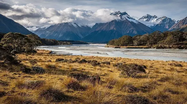
Set expectations correctly before you go: Macetown is not a reconstructed heritage village with information boards at every corner. It’s a scattering of stone foundations, a couple of surviving chimneys, remnants of old walls, and fruit trees that residents planted more than a century ago and that still fruit in season. The site sits in Otago high country, surrounded by tussock hillsides that show almost no other sign of the town that once filled this gully. That absence is the point — a town this size leaving this little behind tells you more about how completely the rush came and went than any amount of signage could.
Walking around the site takes less time than getting there. Most of the value in a Macetown day is in the drive itself: the crossings, the narrowing gorge, the sense of a working gold-rush landscape that hasn’t been smoothed over for visitors.
Practical notes before you book
- Wear clothes you don’t mind getting wet or muddy. Spray comes through open-sided 4WD vehicles at several of the crossings.
- Bring a jacket regardless of the forecast in Queenstown. The gorge holds cooler air than the surrounding basin.
- Don’t attempt this route in a standard rental car, a campervan, or anything without genuine 4WD capability and high clearance — see the note above on insurance.
- Build in a buffer day if Macetown is important to your trip; river-level cancellations are common enough that a fixed one-day window is a real risk.
- Check current DOC and operator advisories before a self-drive attempt; conditions on unbridged fords change with rainfall upstream that you may not see or feel where you’re standing.
Frequently asked questions about visiting Macetown
How many river crossings does the road to Macetown have?
Around 25 fords of the Arrow River, spread over about 15 kilometres of unsealed track between Arrowtown and the Macetown site. The exact number shifts slightly year to year as the riverbed moves.
Can I drive to Macetown in a rental car?
No. Every mainstream rental agreement in Queenstown and Arrowtown excludes the Macetown road by name, alongside Skippers Canyon. Driving it in a rental voids your insurance completely, crossing or no crossing.
Is Macetown accessible after rain?
Often not. The Arrow River rises quickly after rain in the surrounding hills, and fords that are ankle-deep in the morning can be impassable by afternoon. Guided tours postpone or cancel in these conditions rather than risk a crossing.
How long does the Macetown 4WD tour take?
A guided return trip from Queenstown or Arrowtown runs a full day, typically six to seven hours including the drive to and from Arrowtown, the crossings themselves, and time to walk around the site.
Can I gold pan at Macetown?
Yes, panning in the Arrow River near the site is allowed and is usually built into guided tours, with equipment provided. Don’t expect much more than colour in the pan; the easy gold was worked out in the 1860s.
Is Macetown the same place as the Macetown gully worked in the gold rush?
Yes. The modern access road follows the same gully the 1862 rush worked, and the surviving stone foundations, chimneys and plantings sit on the original town site above the river.
What’s the best time of year to visit Macetown?
Late spring through autumn, when the river is lower and more predictable. Winter brings snowmelt and ice on the crossings; heavy rain at any time of year can close the road for days.
Can I walk or bike to Macetown instead of driving?
Yes. The same route is a popular mountain bike ride and a long day walk for fit, well-prepared visitors, both following the 4WD track and its fords rather than a separate path.
4WD & off-road tours on GetYourGuide
Verified deep-linked GetYourGuide tours. Book through these links and we earn a small commission at no cost to you.
GetYourGuide does not provide a product photo for this activity — the image shows the meeting point, photographed by us.