Doing Middle-earth by self-drive: a realistic one-day route
Can you do Lord of the Rings sites around Queenstown as a self-drive day trip?
Yes. Kawarau Gorge, Arrowtown and Glenorchy are all sealed roads reachable in a rental car within a day. The unsealed road on to Paradise adds fords that need real caution, and anything further into the valley needs a 4WD tour or guide.
What a day of self-drive filming locations actually covers
Queenstown sits at the centre of more on-screen Middle-earth than any other town in New Zealand, and most of it is within a short drive on sealed or lightly graded roads. That’s the good news. The less advertised part is that the two locations most associated with Lord of the Rings tourism here — the wider Paradise valley and the approaches beyond it — sit at the end of an unsealed road with several fords, and the genuinely spectacular stretches further in are 4WD or guided-tour territory, not rental-sedan territory.
This is a route for one day, done properly: Kawarau Gorge on the way out of town, a stop in Arrowtown, the drive to Glenorchy, and — conditions permitting — the gravel road on to Paradise. It skips Skippers Canyon and Macetown entirely, because those roads are excluded from almost every rental agreement, and it treats the fords past Glenorchy as the one part of the day that needs a hard rule, not just enthusiasm.
The route at a glance
| Stop | Distance from Queenstown | Drive time | Road surface |
|---|---|---|---|
| Kawarau Gorge / Gibbston Valley | 20–25 km | 20–25 min | Sealed |
| Arrowtown | 20 km | 20 min | Sealed |
| Glenorchy | 46 km | 45 min | Sealed |
| Paradise | 66 km | 60–75 min | Unsealed, gravel, fords |
Add stopping time and the fords, and a realistic day is 8 to 10 hours door to door, not the 4 to 5 hours the driving alone suggests. Fuel up before leaving Queenstown or in Arrowtown — Glenorchy has one petrol station and no bank, and there is nothing at all between Glenorchy and Paradise.
Kawarau Gorge: the first stop out of town
The Kawarau Gorge road runs alongside the Kawarau River on the way toward Gibbston and Cromwell, and it’s worth the short detour before doubling back toward Arrowtown. The cliffs above the gorge, near the historic Kawarau Bridge, are widely cited as the location plate used for the Pillars of the Kings — the two great carved figures were added digitally in post-production, so what you’re looking at on the ground is the raw landscape rather than a built set. It photographs well regardless of whether you know the film history: steep schist walls, a turquoise river a long way below, and the bridge itself worth a stop even without the bungy queue.
There’s no dedicated car park for gazing at the gorge walls specifically — use the bridge car park, which also serves the bungy operation, and walk a short distance along the road shoulder for a clear view down the gorge. Don’t stop on the bridge itself or on blind corners; this road carries genuine traffic and coach buses.
Arrowtown: gold rush streets that also did Rivendell’s approach
Arrowtown earns its own stop on any Queenstown itinerary for the 1862 gold rush history alone — Buckingham Street’s roughly sixty heritage buildings, the Chinese settlement, the Lakes District Museum. For a Middle-earth route, the relevant ground is the Arrow River and Bush Creek area on the edge of town, commonly identified as the setting used for the Ford of Bruinen sequence, where Arwen’s river crossing was filmed. The riverbed here is shallow, accessible on foot from town, and doesn’t require any special access.
Give Arrowtown 45 minutes to an hour if you’re also allowing time for coffee or lunch on Buckingham Street. If you’re visiting in April, the poplars and larches around town turn — a genuinely worthwhile reason to build in extra time here, on a roughly two-week window that moves slightly year to year.
Glenorchy: the gateway, and where phone coverage ends
The 46 km drive from Queenstown to Glenorchy is one of the more scenic stretches of sealed road in the country, running along the edge of Lake Wakatipu with the Humboldt and Richardson ranges on the far side. Glenorchy itself is small — around 360 people — with a red-shed wharf that’s been photographed more than almost any other single structure in the region, a boardwalk over the wetland, and trailheads for the Routeburn and Greenstone-Caples tracks at the edge of town.
This is also the last point with reliable fuel, food and mobile coverage before the road continues toward Paradise. Treat it as a mandatory stop for a top-up and a toilet break, not just a photo stop — there is nothing beyond it until you’re back.
Paradise: gravel, fords, and the rule that matters more than the scenery
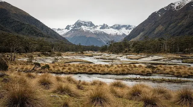
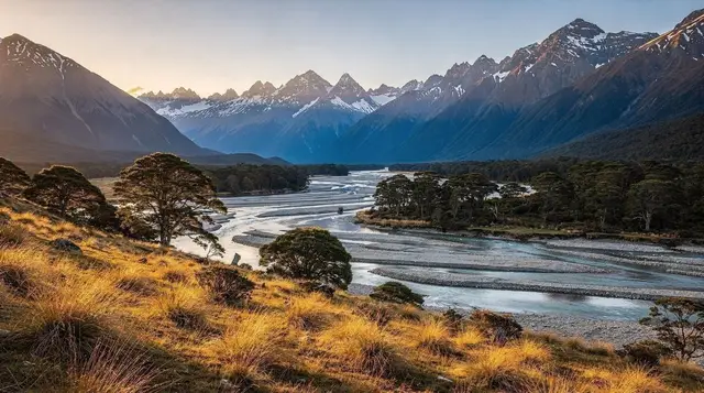
Twenty kilometres past Glenorchy, the sealed road ends and becomes gravel on the way to Paradise — the wider valley setting that stood in for several Middle-earth locations, including scenes associated with Lothlórien and Isengard establishing shots. It’s genuinely one of the most photogenic drives in the area: braided river flats, beech forest, the Richardson Range close on one side.
It’s also where the day’s actual risk sits, and it isn’t the gravel — it’s the fords. Several small streams cross the road on the way to and around Paradise, and their depth and flow change with rain in the mountains, sometimes within hours, regardless of what the weather is doing in Queenstown or Glenorchy.
The rule, and it’s non-negotiable:
- Stop and get out before committing to any ford. Walk to the water’s edge — never into moving water — and look at how it’s running.
- If the water is at or above your wheel rims, don’t cross. A standard rental sedan has neither the ground clearance nor the sealed electronics to risk it.
- If the water is discoloured or moving fast, don’t cross, even if it looks shallow. Colour and speed are the two signs of recent rain upstream, and upstream is exactly where you can’t see.
- It rained in the ranges recently? Turn around. The Dart and Rees river catchments feed this valley and rise fast — faster than the weather at road level tells you.
- Someone else made it across doesn’t mean you should follow. Conditions change between vehicles, especially after a heavier one has already softened the crossing.
- If in doubt, don’t. There’s no mobile coverage here and no recovery service. Turning around costs you twenty minutes. Getting stuck costs you the rest of the day, or worse.
Some rental agreements place restrictions on travel this far from Queenstown — check your paperwork before you leave the depot rather than finding out at the ford. In good, dry conditions the road is manageable in an ordinary rental car at a sensible pace; it simply isn’t a road to treat casually, and it isn’t one to push through after rain.
What isn’t a self-drive stop
Two things get mentioned in the same breath as this route that don’t belong on it in a rental car.
Skippers Canyon and Macetown, reached by a separate unsealed road north of Arrowtown, are explicitly excluded from almost every rental car agreement in the region. The road is narrow, cut into cliff faces, with no barriers and no room to pass in places — genuinely a 4WD or guided-tour road, not a detour to add on. See the Skippers Canyon 4WD tour guide and the Macetown gold heritage guide if that history interests you; do it as a booked trip, not an extension of this one.
The country beyond Paradise, further into the Dart valley toward the true wilderness settings, either requires a 4WD vehicle with local knowledge or isn’t reachable by road at all. If you want to go further than the fords allow — or want someone else making the ford calls — a guided option covers the same ground with a driver who checks conditions daily:
a guided Glenorchy and Paradise Middle-earth tour that continues past the point most rental drivers should reasonably turn around.
An alternative if you’d rather not drive it yourself
Not everyone wants to be the one making ford calls on a gravel road with a rental car’s excess sitting in the back of their mind. A self-drive but GPS-guided buggy option covers similar ground on a set route with support if something goes wrong:
a self-drive guided buggy tour that takes the decision-making about road conditions off your plate while still putting you behind the wheel.
If Arrowtown is the part you care about most and you’d rather not deal with a car at all for that leg, there’s also a cycling option that links it back to Queenstown along the river:
a self-guided bike ride from Arrowtown back to Queenstown — a slower, car-free way to see the Arrow River stretch without adding driving time to the day.
Photo stops and realistic timing
| Stop | Suggested time | What to look for |
|---|---|---|
| Kawarau Gorge lookout | 15–20 min | Gorge walls, bridge, river below |
| Arrowtown / Arrow River | 45–60 min | Buckingham Street, riverbed, Chinese settlement |
| Glenorchy wharf | 20–30 min | Red shed, lake and mountain backdrop, fuel stop |
| Paradise road (if conditions allow) | 60–90 min | River flats, beech forest, valley views |
Build in slack rather than scheduling back to back — coach traffic on the Glenorchy road, roadworks, and simply wanting longer at the wharf than planned are all common. Starting by 9 am gives enough daylight margin to turn around at Paradise without racing the light home, particularly outside the long days of summer.
Fuel, coverage, and other logistics that catch people out
Fuel is available in Queenstown, Arrowtown and Glenorchy — nowhere else on this route, and definitely not between Glenorchy and Paradise. Mobile coverage is patchy from Arrowtown onward and effectively absent past Glenorchy; download offline maps before you leave and tell someone your expected return time. There are basic toilets in Glenorchy but limited facilities beyond it, so plan accordingly.
If you’re renting a car for this specifically, it’s worth reading the fine print on where the vehicle is and isn’t covered before you book — see the car rental guide and the broader notes on driving conditions across the South Island for what “unsealed road” actually means for insurance excess in New Zealand.
Combining it with other Middle-earth sites
This route deliberately stays inside a single realistic day. If you want a fuller sweep of Lord of the Rings locations around Queenstown, including sites that need a boat or a longer drive, a two-day version exists for exactly that reason — see the Lord of the Rings two-day itinerary, which spreads the Paradise leg and an extra location or two across two less rushed days rather than cramming everything into one.
For a broader look at what else fits into a single day near Queenstown, including options that don’t involve gravel roads or fords at all, the best day trips from Queenstown guide is a reasonable next stop.
And if the Dart River valley or the Routeburn Track trailhead has caught your interest along the way, both deserve a separate day rather than an add-on — the Dart River is genuinely better seen by jet boat than from a car window, and the Routeburn trailhead marks the start of a multi-day walk, not a lookout. For more on what a guide covers that a self-driver can’t, the Glenorchy Middle-earth tours guide breaks down where guided access goes further than the road does.
Middle-earth self-drive questions answered
Do I need a 4WD to drive to Paradise?
No. The road to Paradise is unsealed gravel with several fords, manageable in a standard rental car in dry conditions if you drive slowly and check each ford. After heavy rain in the ranges, even a 4WD isn’t a reason to push on.
How do I know if a ford is safe to cross?
Stop, get out, and look before you commit. If the water is above your wheel rims, moving fast, or discoloured, do not cross — turn around and drive back to Glenorchy. There is no phone coverage and no recovery service out there.
Which Lord of the Rings sites can I actually see without a guide?
Kawarau Gorge, the Arrow River area near Arrowtown, and the Glenorchy-Paradise road are open to any driver. Sites further into the valley, and locations reached only by 4WD track or helicopter, need a booked tour.
Is Skippers Canyon part of this route?
No. Skippers Canyon and Macetown sit on a separate unsealed road north of Arrowtown and are explicitly excluded from most rental car agreements — treat them as a guided 4WD trip, not a self-drive stop.
How much time should I set aside?
A full day, roughly 8 to 10 hours door to door, including the drive out to Paradise and back, stops in Arrowtown, and fuel and food breaks. Glenorchy has one petrol station and no bank, so fuel up in Queenstown or Arrowtown first.
Is there fuel and phone coverage along the way?
Fuel is available in Queenstown, Arrowtown and Glenorchy, but nowhere between Glenorchy and Paradise. Mobile coverage drops out past Glenorchy, so download maps and let someone know your return time before you leave.
Can I combine this with the Routeburn or Dart River?
Only if you shorten the Paradise leg. The Routeburn and Greenstone-Caples trailheads are at the very end of the road and the Dart River valley is best seen by jet boat, not from the car — treat either as a reason to come back rather than adding it on the same day.
Lord of the Rings tours on GetYourGuide
Verified deep-linked GetYourGuide tours. Book through these links and we earn a small commission at no cost to you.
GetYourGuide does not provide a product photo for this activity — the image shows the meeting point, photographed by us.