Where the turquoise comes from
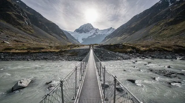
Drive past Glenorchy to the head of Lake Wakatipu and the Dart River is usually the first thing that stops the conversation in the car: wide, shallow, braided channels of glacial water in a colour that looks retouched even when it isn’t. It isn’t dye and it isn’t a filter.
It’s rock flour, fine sediment ground off the mountains by glaciers further up the Mount Aspiring range and carried down in suspension. On a clear day with the sun high, the effect is genuinely striking. Under cloud, or in the hour after rain has stirred up the bed, the same river runs a duller grey-green. Anyone planning a trip around a particular photograph should build in flexibility, because the colour is weather-dependent, not guaranteed.
The Dart is also, technically, a braided river rather than a single channel: it splits and rejoins across a wide gravel bed, and which channel carries the most water can change from one month to the next. That single fact underpins almost everything else on this page, from why jet-boats are the practical way to see it, to why trips get cancelled for reasons that have nothing to do with an operator’s booking calendar.
Getting to the river: Glenorchy and Paradise
Queenstown to Glenorchy is 46 km along the lake, about 45 minutes on a sealed, scenic road that most rental cars handle without trouble in normal conditions. Glenorchy itself is small: roughly 360 permanent residents, one petrol station, no bank, and it functions mainly as the gateway to the head of the lake rather than a destination to linger in for its own sake.
Paradise is a further 20 km past Glenorchy, on an unsealed road that crosses several fords. In dry weather these are a minor inconvenience; after rain they can rise enough to make the crossing unwise, and there’s no petrol, no phone signal to speak of, and no one coming to help quickly if a self-driven car gets into trouble.
Most Dart River operators solve this by including transfers from Queenstown or Glenorchy in the trip price, which is the simpler option for most visitors. Anyone self-driving should check current conditions before setting out; see driving in New Zealand’s South Island and confirm what a rental agreement actually covers via car rental in Queenstown before assuming the fords are fair game.
What a Dart River jet-boat trip involves
The core product on this river is the jet-boat: a flat-bottomed craft designed to run in water barely deep enough to wet the hull, which is exactly what a braided river offers. Trips typically launch from a base near Glenorchy or Paradise, run upriver through the braids and into a narrower, forested gorge section, and include the tight 360-degree spins the operators are known for. A half-day trip, door to door from Queenstown with transfers, is the standard format; expect to pay roughly NZD 200-350 per person depending on distance covered, add-ons and the season, with winter rates sometimes lower but the departure schedule thinner.
The immediate surroundings are worth the trip on their own terms even without the speed: beech forest running down to gravel flats, the Mount Aspiring range at the head of the valley, and a quietness that’s a genuine contrast to central Queenstown. For a side-by-side look at how this compares to the Shotover and Kawarau jet-boat options closer to town, see jet-boat trips in Queenstown compared.
Funyaks and other add-ons
Some Dart River itineraries add a funyak leg: a small, stable, semi-rigid inflatable canoe, usually paddled solo or in pairs down a calmer side channel or lagoon after the jet-boat has covered the distance upstream. It’s a slower, quieter way to finish, often paired with a short walk through beech forest in between, and it suits people who want a taste of self-propelled paddling without a full day of it.
There isn’t a Dart-specific funyak tour in our booking list at the time of writing, so anyone set on that exact combination should check directly with Glenorchy-based operators. The closest bookable equivalent we can point to sits over in the Wanaka basin rather than on the Dart itself:
a guided packrafting trip out of Wanaka gives a comparable taste of calm, glacier-fed water in an inflatable craft, worth considering if the Dart’s own funyak slots are full or the timing doesn’t line up.
For a broader view of paddling options around the lake itself, rather than the Dart valley, see kayaking on Lake Wakatipu.
Why trips get cancelled: the braided river problem
This is the part that’s easy to skip over in the brochure and worth taking seriously when booking. Because the Dart is braided, its channels aren’t fixed: heavy rain in the valley, or snowmelt further up towards Mount Aspiring, can raise the water level and change the deepest, safest line through the gravel within a day or two. Operators who run jet-boats professionally treat this as a genuine safety limit, not a scheduling inconvenience, and will reschedule or cancel a trip rather than run it on a river they consider unpredictable that day.
Practically, that means two things worth planning around. First, don’t book a Dart River trip for the last available slot of a tight itinerary; give it a spare day if the weather forecast for the Glenorchy-Paradise area looks unsettled. Second, check what the operator’s rain and cancellation policy actually says before paying, since terms vary. The same caution applies to travel insurance: adventure activities including jet-boating aren’t always covered by standard travel policies, so it’s worth reading the fine print; see travel insurance for adventure activities before assuming a cancelled trip, or an accident on one, is covered.
Mount Aspiring, Te Wahipounamu and the wildlife
The Dart valley sits inside Mount Aspiring National Park, itself part of the wider Te Wahipounamu South West New Zealand World Heritage Area that also covers Fiordland, Aoraki/Mount Cook and Westland. That listing exists because of the scale and intactness of the landscape rather than any single feature: glacier-carved valleys, temperate beech forest and a river system still doing what braided rivers do, largely undisturbed. Mount Aspiring / Tītitea itself is visible from parts of the upper valley on a clear day, though it isn’t the dominant view from the lower Dart the way it is from Wanaka.
The forest along the river is genuine habitat, not scenery dressing: kea turn up here as they do throughout the alpine parts of the South Island, and the beech forest supports native birdlife that’s harder to see in the more open, grazed country closer to Queenstown. None of it is guaranteed on a fast jet-boat trip, since speed and wildlife-spotting don’t combine well; anyone specifically keen on birdlife is better served by a slower operator or a short forest walk add-on. For the wider regional picture on what’s realistic to see and where, see wildlife of Otago and Southland.
The Dart and the Routeburn
The head of the lake is also where several of the region’s best-known tramping routes begin, and it’s easy to conflate them. The Routeburn Track (32 km, 2-4 days) starts near a road end a short drive past Glenorchy on the Routeburn side of the valley system, not on the Dart itself.
The Dart and neighbouring Rees valleys carry their own multi-day route, popular with trampers doing a loop through this country, and some jet-boat operators run transport further up the valley specifically to shorten the flat, less scenic early walking for hikers heading into that backcountry. It’s worth confirming with an operator whether “Dart River” in their trip name means the day-trip jet-boat product covered above, or a tramper transport service, since the two are priced and scheduled differently.
For those weighing up a full walk versus a jet-boat day trip, Great Walks near Queenstown and the dedicated Routeburn Track guide cover distances, huts and bookings in more depth than makes sense here.
An aerial view is the other way to take in how the Dart, Routeburn and Paradise valleys fit together, since the braided pattern of the riverbed and the scale of the surrounding peaks read far more clearly from the air than from the water:
a helicopter tour departing Glenorchy that takes in the scenic country toward Milford Sound passes over this same head-of-lake landscape en route, weather permitting.
Dart valley on screen
The beech forest and open gravel flats around Paradise, just past the Dart, were used for several exterior scenes in the Lord of the Rings film trilogy, which is why Glenorchy features on location-focused tours alongside its own considerable scenery. It’s a genuine drawcard for some visitors and entirely beside the point for others, so it’s worth knowing in advance rather than being surprised either way. For more detail on what’s actually on the ground versus what’s simply claimed to be, see Glenorchy Middle-earth location tours and, for a self-drive version, the Lord of the Rings self-drive itinerary.
If canyon terrain and moving water in this same valley system appeal more than a river trip, the neighbouring Routeburn Valley also hosts canyoning:
a full-day canyoning tour through the Routeburn Valley covers a different, narrower stretch of water than the open Dart braids, with abseiling and jumps built into the route.
Planning a Dart River day
| Option | Typical duration | Rough price per person (NZD) | Best for |
|---|---|---|---|
| Jet-boat only, Queenstown transfer included | Half day (4-5 hours door to door) | 200-280 | First-timers, limited time |
| Jet-boat plus funyak or forest walk | Half day, slightly longer | 260-350 | Wanting a slower, quieter finish |
| Self-drive to Glenorchy, no booked activity | Half day | Fuel only | Photography, the wharf, a short walk |
| Self-drive to Paradise (dry conditions only) | Half to full day | Fuel only | Confident drivers, LOTR locations |
| Combined with the Routeburn road end | Full day | Varies with activities chosen | Hikers scouting the trailhead |
Prices are indicative and move with season, fuel costs and operator; always check the current figure at booking rather than relying on any number printed here.
Dart River funyaking and jet-boat FAQs
Why is the Dart River turquoise?
The colour is rock flour: fine sediment ground off the mountains by glaciers upstream and suspended in the meltwater. It scatters light the way clay in a glass of water would, and it is most vivid on a clear day with the sun overhead, less so under cloud or straight after rain has muddied the flow.
What’s the difference between the jet-boat and a funyak trip?
The jet-boat covers distance fast, skimming across shallow braids at speed with 360-degree spins built in. A funyak is a small, semi-rigid inflatable canoe, usually added as a slower, quieter finish on a side channel or lagoon, often combined with a short forest walk in between.
Is a Dart River trip ever cancelled?
Yes, and more often than the glossy photos suggest. The Dart is a braided river: its channels shift within days, and heavy rain in the valley or on the Southern Alps can raise the level and colour of the water enough that operators cancel or reroute for safety. Build in a spare day if this trip matters to your itinerary.
How do I get to the Dart River from Queenstown?
Most visitors book a return shuttle or transfer with their jet-boat operator, since the base is beyond Glenorchy, 46 km and about 45 minutes from Queenstown by the lake road. Self-driving is possible on sealed road as far as Glenorchy; the last stretch towards Paradise is unsealed.
Can I drive to Paradise myself?
Yes, in a normal car in dry conditions, but the road past Glenorchy is unsealed and crosses several fords that rise after rain. Check conditions before you go, don’t attempt a flooded ford, and note that services stop at Glenorchy: no fuel, no supermarket, and patchy phone coverage beyond it.
Is the Dart River connected to the Routeburn Track?
They share the same valley system at the head of the lake. The Routeburn Track’s northern end starts near the Routeburn road, a short drive past Glenorchy, and some jet-boat operators run tramper transport further up the Dart and Rees valleys, cutting hours off the walk in for hikers heading into the wider Mount Aspiring backcountry.
Was the Dart valley used in Lord of the Rings?
Yes. The Paradise and Dart River area, with its beech forest and braided flats, was used for several exterior scenes in the film trilogy, which is why it turns up on Glenorchy-based Middle-earth location tours alongside the more famous Glenorchy wharf shots.
Is the jet-boat trip suitable for children?
Most operators set a minimum age or height rather than banning children outright, and life jackets are compulsory and provided. The water is cold year-round, so anyone who goes overboard, which is rare but does happen, needs to be able to cope with a sudden cold-water shock; check the specific operator’s policy when booking.