The road to the head of the lake
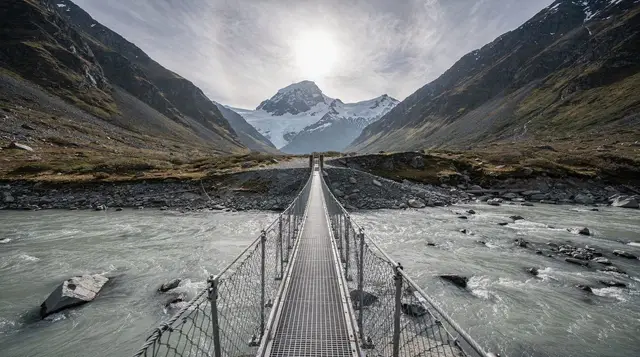
Glenorchy sits at the far end of Lake Wakatipu from Queenstown, 46 kilometres and about 45 minutes away on a road that is regularly named among the most scenic drives in New Zealand. It earns the description without needing much help: the lake on one side, the Richardson Mountains and the Humboldts on the other, and almost nothing built in between.
Unlike Skippers Canyon on the other side of Queenstown, this road is fully sealed, has no toll, and carries no rental car exclusion — any hire vehicle can drive it. See driving in New Zealand’s South Island and car rental in Queenstown before you commit to self-driving.
The road hugs the lake shore for most of its length, with a handful of pull-offs worth using rather than photographing through a moving windscreen. Bennetts Bluff, about halfway along, is the standard lookout: the lake curling away below, Queenstown and the Remarkables receding behind, and on a clear day the mountains at the head of the lake already visible ahead. There is no fuel, no shop and only patchy mobile coverage along this stretch, so treat it as a self-contained trip rather than something to top up on the way.
Buses and shuttles run from Queenstown to Glenorchy for anyone who doesn’t want to drive, largely timed around Routeburn and Greenstone-Caples trampers. Compare the options at buses and shuttles in the southern lakes if you’d rather not deal with the fords further on.
A village of about 360 people
Glenorchy itself is small enough to see properly in an hour: a general store, a couple of cafés, a pub, holiday accommodation, and the wharf. The image everyone comes for is the red shed — officially a wool shed turned boat shed — sitting on the wharf against the lake and mountains, and photographed by nearly every visitor who arrives with a camera or a phone. Early morning and late afternoon give the best light and the fewest people in front of it; midday in summer means sharing the frame.
The wharf itself is a working structure as much as a photo spot, used by boats heading further up the lake and by the jet boat operators running trips from Glenorchy up the Dart River into glacially carved country that a road can’t reach.
The wetlands boardwalk
A short walk from the village centre, the Glenorchy wetlands boardwalk is an easy, flat loop over raised timber decking through reed beds and wet grassland at the head of the lake, with the mountains as a backdrop for almost the whole circuit. It takes 20 to 40 minutes depending on how often you stop, suits any level of fitness, and is one of the better places in the region for birds without needing a guided tour — pūkeko, scaup and, with some luck, crested grebe. It’s free, it’s open at any hour, and it’s the easiest way to spend half an hour in Glenorchy beyond the wharf.
Where the Great Walks begin
Glenorchy is the practical base for two of New Zealand’s Great Walks, and this is arguably its biggest draw for anyone spending more than an afternoon in the region.
| Track | Length | Typical duration | Trailhead access from Glenorchy |
|---|---|---|---|
| Routeburn Track | 32 km | 2–4 days | Routeburn Shelter, about 45 min further on |
| Greenstone–Caples | Around 60 km combined loop | 3–4 days | Greenstone car park, similar distance |
The Routeburn Track is the better known of the two, crossing from Mount Aspiring National Park into Fiordland over the Harris Saddle, with alpine views most Great Walks can’t match for the effort involved. Because it’s a one-way track between two different road ends, almost everyone uses a shuttle or a booked transfer rather than leaving a car at either trailhead — read the Routeburn Track guide before booking huts, which open for reservations each May for the following season and sell out within hours for the popular nights.
The Greenstone–Caples track is the quieter alternative, a loop rather than a one-way route, with gentler valley walking and none of the Routeburn’s alpine crossing. It gets a fraction of the foot traffic and suits trampers who want solitude over drama. Both tracks share a trailhead area and both are covered, alongside other regional options, in Great Walks near Queenstown.
Day walkers who don’t want a multi-day commitment can still get a taste of both tracks from the car park end without booking a hut — worth knowing if your schedule is a single day rather than three or four.
For a faster way to see the alpine country the trampers walk into over days, several helicopter operators fly from Glenorchy into the same valleys.
a helicopter tour over the alpine lakes and into Fiordland covers in under an hour what the Routeburn takes days to reach on foot, and a 45-minute flight to the Earnslaw Burn glacier and waterfalls reaches a hanging valley with no walking track into it at all.
Paradise, and where the sealed road stops
Beyond Glenorchy the road continues about 20 kilometres to Paradise, a scattering of farmland and forest rather than a settlement, named — depending on who tells the story — either sincerely or with a rural sense of humour. The sealed road ends not long after Glenorchy, and the gravel that follows crosses several unbridged fords that can rise quickly after rain and are genuinely impassable at times. This section is explicitly excluded from most rental car agreements, in the same way Skippers Canyon is excluded on the other side of Queenstown, and treating it as a normal back road is how visitors end up stuck mid-ford or off the road entirely.
For anyone without a suitable 4WD, the practical options are a guided tour, a shuttle, or turning around at the point where the surface changes. A private day trip that combines Glenorchy with onward touring is one way to see Paradise without the exclusion risk.
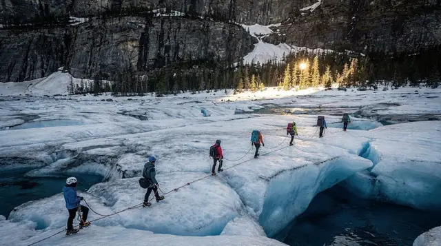
a private day trip covering Glenorchy and Wanaka takes the driving decision off your hands entirely, while a scenic flight is the fastest way to see the country beyond the fords without a 4WD at all — a 40-minute blue ice glacier flight departing Glenorchy gets over the Paradise valley and up into permanent ice within the hour.
Lord of the Rings locations
Paradise and the wider Glenorchy valley did heavy duty as Middle-earth during filming, standing in for Lothlórien, Isengard and Ithilien among other locations, and the valley’s beech forest and open river flats explain why: it looks like almost nowhere else accessible by road in New Zealand. Unlike some film locations that need real imagination to place, several spots around Paradise are still recognisable against stills from the films.
Finding the actual sites without local knowledge is difficult — paddocks and forest edges look similar from a moving car, and there’s minimal signage by design, partly for the working farmland underneath. A guided location tour solves this directly: Glenorchy Middle-earth tours covers the operators and what each one actually shows you, while Lord of the Rings locations around Queenstown puts Glenorchy in context against the other regional sites, and a self-drive Lord of the Rings itinerary is there for anyone who wants to do it independently with a proper map rather than guesswork.
The trap: minimal services
This is worth stating plainly before it becomes someone’s problem on the day. Glenorchy has one petrol station and no bank or ATM. Beyond the village, toward Paradise, there is nothing — no fuel, no shop, no reliable mobile signal. If you’re driving from Queenstown, fill the tank before you leave or at the Glenorchy station itself, and don’t assume cards will work everywhere; the general store and cafés are the safest bets, but carrying some cash removes the risk entirely.
The same applies to anyone walking the Routeburn or Greenstone-Caples: Glenorchy is the last point with real facilities before the trailhead, and huts along both tracks have no shop, no power point for charging devices beyond what’s provided, and no phone signal for long stretches. Plan supplies, cash and charged devices accordingly, and check current conditions with the Department of Conservation before setting out — river levels and weather change faster in this valley than a forecast checked in Queenstown two days earlier will tell you.
When to visit
November to April gives the most reliable combination of open Great Walk huts, a dry-enough road to Paradise, and good light for the wharf and wetlands. Summer (December–February) is busiest and warmest; shoulder months either side thin the crowds without giving up much weather. Winter access to the village itself is fine on the sealed road, but the unsealed sections toward Paradise and the trailheads can ice over, and the Great Walk huts are unserviced outside the main season — a different, more self-sufficient kind of trip.
See best time to visit Queenstown for the seasonal picture across the wider region, and how many days in Queenstown if you’re still working out how much time to allocate to Glenorchy against everything else nearby.
If a single day trip from Queenstown is what you’re after rather than a multi-day tramp, Glenorchy slots easily into a wider loop — see the best day trips from Queenstown for how it compares to Arrowtown, Wanaka and Milford Sound as a half-day or full-day option, or Queenstown in 3 days for one way to fit it into a short stay.
For scenic flights specifically, the fuller picture of operators and routes is in helicopter tours around Queenstown, and a Glenorchy helicopter flight combined with a Milford Sound scenic cruise is one way to connect this side of the region with Fiordland in a single day without the 4-hour drive each way.
Glenorchy, Paradise and the Great Walks — the questions people actually ask
How far is Glenorchy from Queenstown, and how long does it take?
46 kilometres, about 45 minutes on a fully sealed road that runs along the western edge of Lake Wakatipu. There is no toll and no rental exclusion on this stretch, unlike Skippers Canyon.
Is there a petrol station in Glenorchy?
One, and it is the last fuel before Paradise and the trailheads. There is no bank and no ATM in the village, so carry cash or make sure your cards work at the general store and cafés before you leave Queenstown.
Can you do Glenorchy as a day trip from Queenstown?
Yes. The village, wharf, red shed and wetlands boardwalk take an hour or two. Add Paradise and you can fill a full day without booking anything, though the unsealed final stretch and the fords rule out most rental cars.
Where do the Routeburn and Greenstone-Caples tracks start?
Both trailheads are beyond Glenorchy village, on the unsealed road toward Paradise. The Routeburn Track shuttle is the easier option for most walkers, since it avoids leaving a car at a trailhead with no security and returning to a different one.
Was Lord of the Rings filmed around Glenorchy?
Yes, extensively. Paradise stood in for several Middle-earth locations and the wider valley appears in multiple scenes. A dedicated location tour or a self-drive itinerary makes far more sense of the sites than driving past them cold.
Can I self-drive to Paradise, or do I need a tour?
You can self-drive as far as the unsealed road allows in an ordinary car, but the final stretch has several fords that rise fast after rain and most rental agreements exclude it. A 4WD tour or transfer is the safer choice beyond that point.
Is Glenorchy the same as Skippers Canyon?
No. They are different roads on opposite sides of Queenstown. Skippers Canyon is the narrow, unsealed, rental-excluded gorge road; the road to Glenorchy is sealed, gentle and open to any rental car.
What’s the best time of year to visit Glenorchy?
November to April, when the Great Walk huts are open, the wetlands boardwalk and wharf are at their most photogenic, and the fords toward Paradise are more predictable. Winter access is still possible but the unsealed sections can ice over.