The Routeburn Track: a practical guide
How long does the Routeburn Track take, and do I need to book?
The Routeburn Track is 32 kilometres one way, usually walked in 2 to 4 days with one or two nights in Department of Conservation huts or campsites. Bookings for the Great Walks season (late October to April) open in May and the popular huts sell out within hours, so book early.
What makes the Routeburn different from a day walk
The Routeburn Track is one of New Zealand’s ten official Great Walks, and it sits in a different category to the half-day loops around Queenstown. It’s 32 kilometres, crosses an alpine pass above 1,200 metres, and it doesn’t loop back to where you started.
You finish on the opposite side of the Southern Alps from where you began, which creates a genuine logistical problem that a lot of first-time trampers don’t work out until they’re already looking at a locked car many hours’ drive away. This guide covers the walk itself, how the Department of Conservation booking system actually works, and — the part most guides skate over — how to get back to civilisation once you’ve finished.
If 32 kilometres and a hut booking sounds like more commitment than your trip allows, the track still has something to offer as a day trip. More on that below.
The track in numbers
| Detail | |
|---|---|
| Distance | 32 km one way |
| Typical duration | 2 to 4 days |
| Highest point | Harris Saddle, around 1,255 m |
| Huts | Routeburn Flats, Routeburn Falls, Lake Mackenzie, Lake Howden |
| Campsites | Routeburn Flats, Lake Mackenzie |
| Great Walks season | Late October to April |
| Start/finish points | Routeburn Shelter (near Glenorchy) and The Divide (Milford Road) |
Outside the Great Walks season the huts drop to a basic, unserviced standard — no gas cookers, no hut warden, no booking requirement — but the alpine section becomes genuinely dangerous with snow, ice and avalanche risk around Harris Saddle. This guide, like the booking system itself, assumes the managed season.
Route breakdown, day by day
Walked from the Glenorchy side, a typical three-day itinerary looks like this:
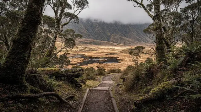
Day 1 — Routeburn Shelter to Routeburn Falls Hut (about 8.5 km, 3 to 4 hours). A gentle climb through beech forest alongside the Route Burn, passing the Routeburn Flats campsite and hut before the track steepens for the final push to Routeburn Falls Hut, perched with views back down the valley.
Day 2 — Routeburn Falls to Lake Mackenzie Hut (about 11.5 km, 5 to 6 hours). The big day. The track climbs above the bushline to Harris Saddle, the highest point on the route, with Lake Harris just below it and — weather permitting — views to the Humboldt and Darran mountains. From the saddle a side trip to Conical Hill (weather-dependent, add roughly 1.5 hours return) gives a look towards Milford Sound itself. The track then descends through the Hollyford Face to Lake Mackenzie.
Day 3 — Lake Mackenzie to The Divide (about 12 km, 4 to 5 hours). Forest walking down to Lake Howden Hut, then the short Key Summit side trip if you haven’t already saved it for later (see below), before the final descent to The Divide on the Milford Road.
Some trampers compress this into two days by pushing further on day one, and some stretch it to four with an easier pace or a rest day at Lake Mackenzie. Either direction is fine — walking from The Divide instead simply front-loads the climbing on day one rather than day two.
Booking huts and campsites
Every bed and every campsite on the Routeburn requires a ticket during the Great Walks season, booked directly through the Department of Conservation. There’s no walking up and hoping for a free bunk the way there is on some non-Great Walk tracks. Two details matter more than anything else:
- Bookings open in May for the following season (late October to April), and Routeburn Falls Hut and Lake Mackenzie Hut — the two most scenic — are frequently fully booked within hours for the popular weekends and the peak of summer.
- You must book specific nights at specific huts, not just a season pass. If your itinerary changes partway through, you can’t simply stay an extra night somewhere without a ticket for it.
If you’re planning a trip more than a few months out, treat the May booking date the way you’d treat a concert on-sale — have your dates decided and be ready at the booking window opens. Turning up in January and hoping to book a week later rarely works for the huts; the campsites, which cost less and carry your own tent, sometimes have more flexibility.
a guided walk on part of the Routeburn with a local guide is worth considering if the hut booking window has already closed for your dates — guided operators hold their own allocation, separate from the DOC public booking pool, and a guided day or half-day still puts you on the same track, on the section around Routeburn Falls or Key Summit.
Getting to both ends — the transport problem
This is the part that catches people out. The Routeburn is not a loop. It starts at the Routeburn Shelter, roughly 25 minutes past Glenorchy and about 70 minutes from Queenstown by road, and finishes at The Divide on the Milford Road, roughly an hour from Te Anau. Drive between the two ends by road and you’re looking at close to four hours, via Queenstown, Te Anau and the Fiordland approach — because the two trailheads are on opposite sides of a mountain range with no road across it.
That means if you drive your own car to the Routeburn Shelter, walk the full track, and finish at The Divide, your car is now four hours’ drive from where you’re standing, with no way to walk back to collect it in a single afternoon. Trampers handle this a few ways:
- Book a shuttle that repositions you, not the car. Leave your car at one end (commercial parking is available near Glenorchy), get a shuttle to the opposite trailhead before you start walking, then walk back towards your car. This is the simplest option if you’re driving yourself.
- Book a shuttle for after the walk. Walk in whichever direction suits your itinerary, then take a shuttle from The Divide (or the Routeburn Shelter, if you finish there) back to wherever your accommodation and car are. Shuttle operators time services around typical Great Walk finishing patterns, but they still need booking ahead, especially in peak season.
- Combine it with a Milford Road trip. Because The Divide sits directly on the Milford Road, some trampers finish the walk and continue straight on to Milford Sound rather than returning to Queenstown the same day, then loop back via Te Anau.
None of these options is free, and none of them is something you can improvise on the day — book the shuttle at the same time you book the huts, not after. If you’d rather not manage the logistics yourself, a guided operator running full-day trips into the Routeburn Valley handles the transport as part of the package, which is the main reason people choose a guided day over a self-guided multi-day trip in the first place.
Key Summit: the day-walk alternative
If the multi-day commitment or the hut-booking window doesn’t work for your trip, Key Summit is the honest alternative. It’s a side trip from Lake Howden, reached from The Divide car park on the Milford Road — a loop of a few hours, well short of the full 32 kilometres, that climbs through beech forest to open alpine tarns and a viewpoint looking down three separate valleys at once: the Hollyford, the Eglinton and the Greenstone.
Because The Divide is on the Milford Road, Key Summit is realistically reached as part of a Milford Sound day trip from Queenstown or from Te Anau, rather than as a dedicated outing on its own — it’s roughly four hours’ drive from Queenstown one way, so it only makes sense bolted onto a trip you’re already making. No hut booking is required for the Key Summit loop itself, since it’s a day walk rather than an overnight stay on the Great Walk.
For those without the time even for that, a helicopter flight over the alpine lakes and Fiordland country covers similar terrain to the Routeburn’s high section from the air in well under an hour, weather permitting — not a substitute for walking it, but an honest option for a short visit.
Season and conditions
The managed Great Walks season runs from late October to April, when huts are serviced, staffed, and bookable. Outside that window — May to September, roughly — the huts lose services and the alpine crossing at Harris Saddle carries real snow and avalanche risk that most visiting trampers aren’t equipped to assess. This isn’t a track to attempt off-season without serious backcountry experience and current avalanche information.
Even within the managed season, weather on Harris Saddle changes fast. Rain, wind and cold are possible on any day of the year at 1,200 metres, and the Conical Hill side trip is genuinely weather-dependent — cloud takes the view away entirely. Pack for four seasons in one day regardless of the forecast at trailhead level, and check the Department of Conservation’s current track and weather advisories before you leave, not the week before.
Practical notes
- Fitness and terrain. Great Walk grading means a well-benched track and bridged river crossings, but day two’s climb to Harris Saddle and back down through the Hollyford Face is a genuine full day on your feet with real elevation gain.
- What to carry. Full wet-weather layers, warm insulation for the saddle even in summer, a proper pack cover, and your own food for every meal — huts have cooking facilities but no supplies. Campers need a stove, fuel and a tent rated for alpine wind.
- Water. Streams along the track are generally reliable, but treat or filter water as a matter of routine.
- Insurance. Check what your travel insurance actually covers for a multi-day backcountry walk before you go — search and rescue and medical evacuation from an alpine hut are a different scenario to a city medical claim, and not every policy treats them the same way.
- Booking everything together. Huts, shuttle and any guided component are three separate bookings with three separate lead times. Sort the transport at the same time as the huts, not as an afterthought once the dates are locked in.
Alternatives if the Routeburn doesn’t fit your trip
If the booking window has closed, the weather forecast is against you, or four days simply isn’t in the itinerary, there are other ways to see similar country without the same commitment. A private four-wheel-drive tour with a local guide gets you into the wider Glenorchy valley system in a few hours rather than days — a private 4WD tour with a local guide covers backcountry roads that no rental car agreement allows you to drive yourself.
A private day trip taking in Glenorchy is a lower-key way to see the head of Lake Wakatipu and the Paradise area, including the road the Routeburn trailhead sits on, without lacing up boots at all.
For a broader look at what else the region offers on foot, see our roundups of Great Walks near Queenstown and the best hikes around Queenstown, or, for shorter options based from the Milford Road end, day walks in Fiordland. Glenorchy and the Routeburn Valley also appear repeatedly on screen — see Lord of the Rings locations around Queenstown if that’s part of the draw.
Routeburn Track questions answered
How long is the Routeburn Track and how many days does it take?
The full track is 32 kilometres one way, from the Routeburn Shelter near Glenorchy to The Divide on the Milford Road. Most trampers take 2 to 4 days, spending one or two nights in huts or at the campsites along the way.
Do I need to book huts on the Routeburn Track?
Yes. During the Great Walks season, from late October to April, every hut and campsite on the Routeburn requires a booked ticket through the Department of Conservation. Outside that season the huts revert to a basic, unserviced standard and bookings are not required, but conditions are far more serious.
When do Routeburn Track bookings open?
The Department of Conservation opens bookings for the following Great Walks season in May. Routeburn Falls Hut and Lake Mackenzie Hut are the two most sought after, and their popular nights are typically gone within hours of booking opening.
How do I get back to my car after walking the Routeburn?
You don’t walk back the way you came, and you can’t simply drive around, because the two ends are on opposite sides of the Southern Alps and roughly four hours apart by road. Most trampers book a shuttle that repositions them, or their vehicle, between the Routeburn Shelter and The Divide before or after the walk.
Can I walk part of the Routeburn Track as a day trip?
Yes. The Key Summit side trip, from The Divide on the Milford Road, is a well-formed loop of a few hours that reaches alpine tarns and a viewpoint over three valleys, without booking a hut or committing to the full 32 kilometres.
Which direction should I walk the Routeburn Track?
Either direction works and both are booked the same way. Starting from the Routeburn Shelter near Glenorchy climbs gradually to Harris Saddle, the high point, while starting from The Divide gets the steepest climbing done on the first morning. Most guided groups start from the Divide end.
Is the Routeburn Track suitable for beginners?
It’s graded as a Great Walk, meaning a well-formed track and swing bridges over the rivers, but it still crosses an alpine pass above 1,200 metres with real weather exposure. Reasonable fitness, proper wet-weather gear and respect for the forecast matter more than technical hiking experience.
Guided walks & hikes on GetYourGuide
Verified deep-linked GetYourGuide tours. Book through these links and we earn a small commission at no cost to you.
GetYourGuide does not provide a product photo for this activity — the image shows the meeting point, photographed by us.