The last stop before the Haast Pass
Makarora is not really a town. It is a scatter of buildings on SH6 — a store, a café, a campground, a handful of houses — sitting in a wide river valley at the northern edge of Mount Aspiring National Park. Past it, the road climbs into the Haast Pass and drops down to the West Coast; before it, everything belongs to Wanaka and the Southern Lakes. For most visitors driving between Queenstown and the glaciers, Makarora is the last place to stop, stretch your legs and see something worth the detour before an hour or more of mountain road with no services at all.
That combination — genuinely striking scenery, a walk short enough to do in trainers, and a location most people are already driving past — is why Makarora punches above its size. The two reasons to stop are the Blue Pools, a 30-minute return walk to glacier-fed water of an almost implausible colour, and the Siberia Experience, a flight-walk-jet boat trip into a valley with no road access. Neither requires more than a day, and either can be added to a longer run toward Franz Josef or Fox Glacier without much disruption to the schedule.
Getting to Makarora from Queenstown
There are two practical routes, and the choice depends mostly on the season and whether you are also stopping in Wanaka.
| Route | Distance | Driving time | Notes |
|---|---|---|---|
| Via Crown Range Road | ~135 km | ~2 hours | Steepest, most direct; unsealed sections and requires chains in winter |
| Via Cromwell and Wanaka | ~180 km | ~2 hours 15 | Sealed the whole way, better in poor weather or towing |
Both routes pass through or near Wanaka, which is the sensible place to fuel up, since Makarora’s services are minimal and there is nothing beyond it until well into the Haast Pass. See our notes on driving in the South Island and on car rental in Queenstown if you have not organised a vehicle yet — most standard rental agreements cover this route without restriction, unlike Skippers Canyon or Macetown.
The Blue Pools walk
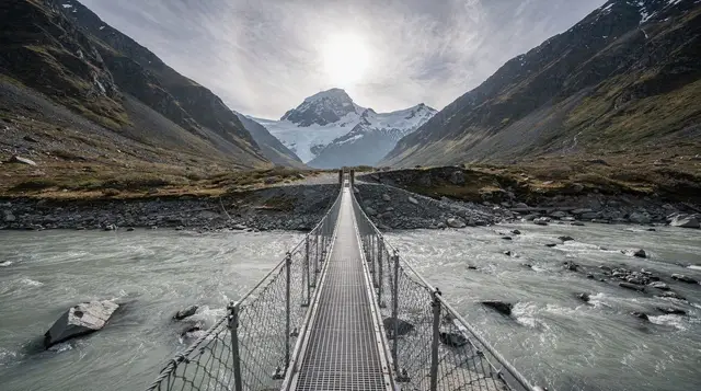
The Blue Pools car park sits a short distance north of Makarora village, signposted off SH6. From there, a well-formed track leads through mature beech forest — mostly flat, with a little boardwalk over the wetter sections — down to a swing bridge across the Makarora River. The pools themselves sit just beyond the bridge, fed by glacial meltwater draining down from the mountains behind the valley.
The colour is the whole point. On a clear, still day the water sits somewhere between turquoise and an electric blue that looks digitally saturated in photographs but is not: fine glacial rock flour suspended in the water scatters light in a way that produces that intensity, and the clarity is such that you can usually see the riverbed several metres down. After heavy rain upstream, though, the same water can turn a flat, silty grey within a matter of hours, so a photograph you have seen online is not a guarantee of what you will find on the day.
Allow about 30 minutes for the return walk at an easy pace. There is no charge, no booking, and no real fitness requirement — this is one of the more accessible short walks covered in our roundup of the best hikes around Queenstown. If you would rather not navigate the car park and track notes yourself, a guided version of the walk covers the same ground with local commentary on the valley’s history and geology:
a guided Blue Pools walk from MakaroraThe bridge that keeps closing — check before you go
The swing bridge over the Makarora River is the one part of this trip that is genuinely worth confirming in advance. It has been closed for repair and rebuilt more than once, most recently after flood and slip damage affected the structure and approach track. When it is closed, the pools themselves are usually still visible from the near bank, but the full loop and the best vantage points are not accessible, and DOC does not always update signage on-site as quickly as its website.
Before driving out from Queenstown or Wanaka specifically for the Blue Pools, check the current track status on the Department of Conservation website, or ask at the Wanaka or Makarora information points. This is a five-minute check that avoids arriving to a taped-off car park after a two-hour drive, and it is worth repeating even if you checked a few weeks earlier — river damage in this valley can happen with very little warning after a heavy rain event.
The Siberia Experience: plane, foot and jet boat
Behind Makarora, the Siberia Valley has no road into it at all — the only way in and out for a day visit is by small plane, on foot, or by jet boat, and the trip that combines all three has become one of the signature experiences based out of this end of the Wanaka region.
It runs in three stages. A short scenic flight lifts off from the Makarora airstrip and drops into the Siberia Valley, giving a close, low view of the surrounding peaks and the braided river flats that most visitors to this valley never otherwise see. From the landing point, a walking section of a few hours follows the valley floor through beech forest and open river flats — this can be self-guided on a marked track or done with a guide, depending on how it is booked. The trip finishes with a jet boat pickup, running the Wilkin and then the Makarora River back down to the village, threading between gravel bars at speed.
Like every flightseeing and helicopter activity in this part of the country, the Siberia Experience runs on weather, not on the calendar. Low cloud or high wind grounds the flight stage, and a cancelled or postponed morning is common enough that it should not be booked for your only day in the region. If you have some flexibility in your itinerary, this is worth pairing with:
a helicopter version of the Siberia flight, walk and jet boat combinationBeech forest and the wider Makarora valley
Makarora sits inside beech forest for almost its entire length — red, silver and mountain beech depending on altitude and aspect — which is part of why the Blue Pools walk feels closer to a rainforest track than the open tussock country further south around Queenstown. The forest is also part of Mount Aspiring National Park, and it carries the birdlife that goes with intact beech habitat: bellbird and tūī are common by sound if not always by sight, and the valley floor’s braided rivers attract wading birds along the gravel flats.
There is a DOC campsite at Makarora for anyone wanting to base here rather than pass through, and the flat, open river country makes for straightforward, gentle walking beyond the Blue Pools track itself if you have more time. This is also the northern gateway to Lake Hawea and the wider Wanaka lakes district, so it is easy to build a day around Makarora that also takes in a swim or paddle back toward Wanaka:
a guided kayak trip on Lake WanakaWhere to stop, eat and fuel up
Makarora’s services are genuinely minimal: a café and small store, a campground, and that is close to the full list. There is no bank, no large supermarket, and fuel should not be assumed to be available — even when a pump exists, hours can be limited outside peak season. The safe approach is to fill the tank in Wanaka before heading north, particularly if the plan is to continue over the Haast Pass afterwards, where the next reliable fuel stop is well down the West Coast side.
The café at Makarora is a reasonable lunch stop if you are timing the Blue Pools walk around a meal, but it is not a destination in itself the way Wanaka’s or Queenstown’s food scene is — see our notes on Queenstown’s restaurants and food scene for what is actually available locally, and plan a proper meal either side of the Makarora stop rather than at it.
Combining Makarora with a Haast Pass or West Coast trip
For most people, Makarora is not an end point but a stage on a longer drive. Past the village, SH6 climbs into the Haast Pass and descends to the West Coast, eventually reaching Franz Josef Glacier and Fox Glacier further down the coast. If that is the plan, doing the Blue Pools walk as a leg-stretch on the way through costs almost no extra time and breaks up what would otherwise be a long, service-free stretch of driving.
Our Queenstown to Franz Josef guide and the four-day Queenstown to West Coast glaciers itinerary both build Makarora in as a stop rather than a separate trip, which is the more efficient way to see it — a dedicated return trip from Queenstown just for the Blue Pools is a long drive for a 30-minute walk, however good that walk is.
If flightseeing is more the appeal than driving further, Makarora and Wanaka are also viable departure points for scenic flights over Milford Sound and the glaciers, without the longer road trip:
a scenic helicopter flight to Milford Sound from WanakaWhen to visit
November to April gives the longest daylight, the driest track conditions, and the best odds of clear, still water at the pools. Winter access is possible — the Blue Pools track itself does not close for snow the way high alpine routes do — but the Crown Range Road, one of the two main approaches, requires chains and is best avoided in poor conditions; the Cromwell route via Wanaka is the safer winter option. See Queenstown’s weather month by month and our broader best time to visit guide for how the seasons play out across the wider region, since conditions at Makarora generally track with Wanaka rather than with Queenstown itself.
Whatever season you go in, build in the DOC track-status check as a habit rather than an afterthought — the bridge closure history here means the walk that looks straightforward on a map is occasionally not available at all, and it costs nothing to confirm before you drive out.
Makarora and the Blue Pools: frequently asked questions
How long is the Blue Pools walk at Makarora?
The main loop from the car park to the swing bridge and back is around 30 minutes at an easy pace, mostly flat through beech forest. Add another hour or so if you continue on to the Makarora River flats or link up with a longer section of track.
Why are the Blue Pools so blue?
The colour comes from glacial meltwater running down from the mountains behind Makarora, carrying fine rock flour that scatters light and gives the pools their intense, almost unnatural blue-green colour. Clarity and colour are both best on a still, sunny day; heavy rain upstream can turn the water cloudy and grey within hours.
Is the Blue Pools swing bridge currently open?
It has been closed and rebuilt before, most recently after flood and slip damage, so treat any online description as provisional. Check the Department of Conservation website or the Makarora i-SITE for the current track status before you drive out, especially after heavy rain.
What is the Siberia Experience?
It is a three-part trip that starts with a short scenic flight from the Makarora airstrip into the Siberia Valley, continues with several hours of guided or self-guided walking through the valley, and finishes with a jet boat ride back down the Wilkin and Makarora rivers to the village. It runs on fine-weather days only.
How far is Makarora from Queenstown?
About 135 km by the Crown Range Road, roughly 2 hours of driving, or a longer but lower route of around 180 km via Cromwell and Wanaka. The Crown Range Road is unsuitable in winter without chains, so check conditions before choosing that route between June and August.
Are there fuel and food options at Makarora?
Makarora has a small store and café and very limited services beyond that — no bank, no large supermarket, and fuel availability is not guaranteed, so it is worth topping up the tank in Wanaka before heading out, particularly if you are continuing over the Haast Pass afterwards.