Tititea, the Matterhorn of the south
At 3,033 metres, Mount Aspiring / Tititea is the highest peak outside the Aoraki / Mount Cook region and the sharp, glaciated pyramid that gives Mount Aspiring National Park its name. Locals and guidebooks alike call it “the Matterhorn of the south” for its shape, though the resemblance is really about the silhouette rather than the scale — Tititea is a serious alpine mountain, not a photo prop.
It sits inside Te Wahipounamu, the South West New Zealand World Heritage area, alongside Fiordland, and unlike most of the big landscapes on this site it is reached from Wanaka, not Queenstown. If your base is Queenstown, treat this as a day out that starts with a drive rather than something you can casually add to an afternoon in town.
The mountain itself is not somewhere most visitors “go” in the way they go to Milford Sound. What you can realistically do is walk into the national park as far as the Rob Roy Glacier, fly over or past the peak from Wanaka, or — if you have the skills and a guide — climb it. All three are covered below, along with the one piece of practical advice that matters most: the road in has fords, and fords are not always crossable.
Getting to the Matukituki Valley
Access to Mount Aspiring National Park from this side is via the Matukituki Valley Road, which runs west from Wanaka along the West Matukituki River to a car park at Raspberry Creek, close to the Aspiring Hut. Budget around an hour from Wanaka township, on top of the 1h 45min drive from Queenstown, so a return trip that includes the walk is realistically a full day rather than a half-day excursion once you’re on the road.
The road is sealed for the first stretch and gravel for the rest, and — this is the part worth repeating — it crosses several fords with no bridge. In normal conditions they’re a shallow, slow crossing that any competent driver manages without drama. After heavy rain in the catchment, the same fords can rise within hours and become genuinely impassable, stranding cars on the wrong side until the river drops.
Check the forecast for Wanaka and the upper Matukituki before you commit to the drive, and don’t push a crossing that looks higher or faster than the ones before it. Many rental car agreements explicitly exclude this kind of road, so read your contract rather than assume; the same caution applies more broadly across the region — see our notes on driving in New Zealand’s South Island and on car rental in Queenstown for what’s typically covered and what isn’t.
There’s no fuel, no shop and only patchy mobile coverage once you leave Wanaka, so fill the tank and tell someone your plan before you go.
The Rob Roy Glacier walk
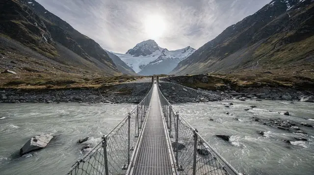
The Rob Roy Glacier track is the walk almost everyone means when they say they’re “doing Mount Aspiring” without actually climbing it. From the Raspberry Creek car park, the track crosses a swing bridge over the Matukituki River, then climbs steadily through beech forest before breaking out onto open bluffs with a direct view of the Rob Roy Glacier hanging below Tititea’s northern slopes. Allow three to four hours return for around 10 kilometres — it’s a genuine climb with some rough, sometimes muddy sections, not a flat riverside stroll, but it needs no special gear beyond decent boots, layers and rain protection.
It’s one of the better half-day walks accessible from Wanaka precisely because it delivers a close-up of a real glacier and a real mountain for a modest amount of effort, which is why it sits alongside our wider list of best hikes around Queenstown and the region’s great walks — though note Rob Roy is a day walk, not a multi-day Great Walk. Waterfalls and avalanche debris are common lower down after heavy rain or thaw, and the track can close temporarily for track work or slips, so it’s worth checking DOC’s current status before driving out.
If you’d rather turn the day into something more active than a there-and-back walk, operators run guided canyoning trips into gorges on the fringe of the national park.
a full-day canyoning trip into the Mount Aspiring area, abseiling and swimming through a river gorge, is a genuinely different way to spend a day in the same landscape, and it’s run as a guided trip so no prior canyoning experience is needed.
Nearby, the short Blue Pools walk near Makarora makes a good add-on if you’re continuing north toward Haast, and operators also run it as a standalone half-day trip from the Wanaka side.
a guided day walk to the Blue Pools near Makarora pairs well with a Matukituki Valley morning if you want two short walks rather than one long one, and it doesn’t require the gravel road or fords at all.
Seeing Tititea from the air
For most visitors on a normal Queenstown or Wanaka itinerary, a scenic flight is the realistic way to see Mount Aspiring properly rather than as a distant shape on the skyline. Fixed-wing and helicopter operators based in Wanaka route flights past the peak and its glaciers on the way to Milford Sound and the West Coast, and some trips include an alpine landing on snow within the national park.
a scenic helicopter flight from Wanaka that tracks past Tititea on its way to Milford Sound covers, in a couple of hours, terrain that would otherwise take days on foot — useful context when deciding whether the road, the fords and the walk are worth your day, or whether the air is the better use of it.
A different option heads into the Siberia Valley, inside the national park itself, combining a flight with a walk and a jet boat pickup.
the Heli Siberia flight, hike and jet boat combination through Mount Aspiring National Park gets you onto park terrain without the drive or the fords, landing in the Siberia Valley for a guided walk before a jet boat run back down the Wilkin and Makarora rivers. It’s not cheap, but it solves the access problem completely, which is worth knowing if the Matukituki Road is running high the day you’re there.
For a fuller comparison of flight types, landing options and what each one actually shows you, see our guides to helicopter tours around Queenstown and alpine and glacier landings explained.
Climbing Mount Aspiring
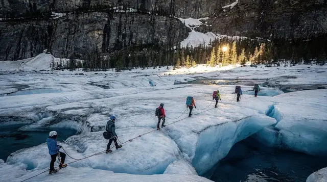
Reaching the summit is a different proposition altogether from the Rob Roy walk, and it’s worth being direct about that so nobody arrives expecting a long day hike. The standard route climbs from Aspiring Hut in the valley to French Ridge Hut, then continues onto the Bonar Glacier and up toward Bevan Col before the final push to the summit ridge — glacier travel, crevasse crossings and roped climbing throughout, on a mountain that regularly turns back experienced parties when the weather or the ice conditions aren’t right.
This is not a walk-up. Unless you already carry your own alpine skills — glacier travel, crevasse rescue, rope work and New Zealand-specific mountain judgement — this is a guided climb, typically run over four to seven days to allow for acclimatisation, hut-to-hut movement and at least one weather day. Guiding companies based in Wanaka run these trips seasonally, mostly in summer when the route is in its most stable condition, though “stable” on Tititea is relative; even guided attempts get weathered off regularly. If mountaineering isn’t your background but the idea appeals, an alpine landing by helicopter — see above — gets you onto glacier terrain and close to the peak without the multi-day commitment.
Compare your practical options at a glance:
| Way to experience Tititea | Duration | Fitness / skill needed | Rough cost |
|---|---|---|---|
| Rob Roy Glacier walk | 3–4 hours return | Moderate fitness, no special skills | NZ$0 (just fuel and, if needed, a rental car) |
| Scenic flight from Wanaka | 1–2.5 hours | None | NZ$300–500 per person |
| Heli-hike into Siberia Valley | Half a day | Moderate fitness | NZ$500–800 per person |
| Guided summit climb | 4–7 days | Prior alpine experience recommended; guided trips accept motivated beginners with fitness | NZ$3,000+ per person |
Where it fits in your trip
Because Mount Aspiring National Park is accessed from Wanaka rather than Queenstown, it makes most sense as part of a Wanaka stop rather than a Queenstown day trip in its own right. If you’re routing through Wanaka on the way to the West Coast glaciers or back from Haast Pass, building in a morning for Rob Roy Glacier or an afternoon scenic flight is a natural fit — see our Queenstown to West Coast glaciers itinerary for how that typically gets sequenced across several days.
Travellers based in Queenstown who don’t want to add a Wanaka overnight can still do this as a long day trip: drive out via Queenstown to Wanaka, walk to the Rob Roy lookout or take a flight, and drive back, though this makes for a full day behind the wheel on top of the walk. If time is tighter, a same-day scenic flight is the more realistic option than trying to fit in both the drive and the walk.
Either way, factor in the region’s other glaciers while you’re in the area — see our roundup of glacier experiences across the wider region for how Tititea compares to Franz Josef and Fox on the coast, and make sure your travel insurance actually covers what you’re planning; our guide to travel insurance for adventure activities explains what standard policies tend to exclude.
If you’re stringing together a longer loop, Lake Hawea, just over the hill from Wanaka, is a quiet detour with none of the driving complications of the Matukituki Road, and worth considering as an easier alternative on a day when the fords are running high.
Visiting Mount Aspiring / Tititea: your questions answered
What does Tititea mean, and why does the mountain have two names?
Tititea is the Māori name, generally translated as “glistening peak”, a reference to the permanent snow and ice on its upper slopes. Both names are in official use, and you’ll see the peak signposted and sold as “Mount Aspiring / Tititea” throughout the region.
How do I get from Queenstown to the start of the Rob Roy Glacier track?
There’s no direct route: drive to Wanaka first (around 1h 45min), then continue on the Matukituki Valley Road to the Raspberry Creek car park, roughly another hour on unsealed road. Queenstown-based operators run day trips that handle the driving for you.
Is the Matukituki Valley Road suitable for a rental car?
It’s gravel for most of its length and crosses several fords that have no bridge, so the honest answer is “usually, carefully”. After heavy rain the fords can rise fast and become impassable, and some rental agreements exclude the road entirely, so check your contract and the forecast before you go.
How long does the Rob Roy Glacier walk take, and how hard is it?
Allow three to four hours return for roughly 10 kilometres, starting with a swing bridge over the Matukituki River and climbing through beech forest to an open bluff below the hanging glacier. It’s a well-formed track but with a genuine climb, not a flat stroll, and it can be muddy after rain.
Do I need a guide to climb Mount Aspiring?
Yes, unless you already have your own glacier travel, crevasse rescue and alpine climbing experience. The standard route crosses the Bonar Glacier and involves roped travel, and guided climbs typically run as multi-day trips using huts such as Aspiring Hut and French Ridge Hut on the approach.
What’s the best way to see Tititea if I don’t want to walk or climb?
A scenic flight from Wanaka is the practical option: fixed-wing and helicopter flights routinely track past the peak and its glaciers on the way to Milford Sound or the West Coast, and some include an alpine landing. It’s the only way to get genuinely close to the mountain in an hour or two.
When is the best time to visit?
December to March gives the most reliable walking conditions and the longest daylight for the Rob Roy track. Scenic flights operate year-round but are weather-dependent in all seasons, so build a spare day into your Wanaka itinerary rather than booking on your only clear-weather day.