Most people who drive Haast Pass aren’t going to Haast at all. They’re on their way from Wanaka to Franz Josef or Fox Glacier, and the pass — properly Tioripatea — is the 120-odd kilometres of narrow, sealed road that gets them there. It’s quieter than the Milford Road, has no bus tours crawling through it, and no permanent services once you leave Makarora. That last part catches people out more than the driving does.
Tioripatea: a road that only opened in 1965
State Highway 6 over Haast Pass wasn’t completed until 1965, which makes it a genuinely recent addition to the South Island’s road network — long after the railways and main highways further east. Before that, the route was walked and used by Ngāi Tahu as a path between Otago and the pounamu (greenstone) sources of the West Coast; the name Tioripatea is generally translated along the lines of “the way ahead is clear”. Sealing the whole route took another three decades after the road opened, which tells you something about how remote this corridor still was through the late twentieth century.
The pass itself is unremarkable to look at from the car — a low saddle at 563 m, the lowest of the South Island’s major alpine crossings, without the switchbacks of the Crown Range or the tunnel drama of the Milford Road. What makes the drive is everything either side of it: beech forest closing in, the Haast River running milky-green below the road, and a run of short, easy waterfalls that don’t ask much of your schedule.
Getting there from Queenstown, via Wanaka
There’s no way to reach Haast Pass from Queenstown without first driving to Wanaka, either over the Crown Range or around via Cromwell. From there the road runs north along Lake Wanaka and Lake Hawea before following the Makarora and Haast Rivers out to the coast.
| Leg | Distance | Approx. time |
|---|---|---|
| Queenstown to Wanaka | 70 km | 1 h |
| Wanaka to Makarora | 65 km | 45 min |
| Makarora to Haast township | 120 km | 1 h 45 |
| Haast township to Franz Josef | 95 km | 1 h 15 |
| Queenstown to Franz Josef (total) | 350 km | About 5 h 30 with stops |
That’s a full day of driving if you’re doing Queenstown to Franz Josef in one go — see our guide to driving from Queenstown to Franz Josef for how people usually split it. If you’re renting a car for this leg specifically, check the terms first: most companies are fine with Haast Pass, but confirm cover for gravel side roads and read our broader notes on driving in New Zealand’s South Island and car rental in Queenstown before you book.
The 120 km with no fuel: Makarora to Haast
This is the one thing to get right before you leave. Makarora, a tiny settlement below Mount Aspiring, has the last fuel stop before the coast. After that there is no petrol station for the full 120 km to Haast township — no garage, no top-up option, nothing. Rental cars with small tanks and drivers who’ve been cutting it fine since Wanaka are the two things that combine to cause problems here.
Fill up in Wanaka if you can, or definitely in Makarora, even if the gauge still shows half a tank. There’s also no mobile coverage for long stretches of this road, so treat it the way you’d treat any remote drive: full tank, a physical map or downloaded offline map, and someone who knows your rough schedule.
What to stop for: waterfalls and lookouts
None of the stops on this drive demand a proper hike. They’re roadside or close to it, which is exactly why the pass works well as a driving day rather than a hiking one.
| Stop | Coming from Makarora | Suggested time |
|---|---|---|
| Blue Pools | First, not far out of Makarora | 20 min return walk, swing bridge |
| Thunder Creek Falls | Roughly halfway to Haast | 10 min return, flat track |
| Fantail Falls | A few minutes further on | 5 min return, roadside |
| Gates of Haast | Close to Haast township | 5 min, swing bridge lookout over the gorge |
The Blue Pools live up to their name on a clear day — genuinely turquoise water fed by glacial melt, reached over a swing bridge. Thunder Creek Falls drops about 28 m through bush and is the closest thing to a “proper” waterfall walk on this road, though it’s still short enough to do in gumboots. Fantail Falls is barely a stop at all — pull in, look, move on. The Gates of Haast, where the road crosses the river gorge on a swing bridge, is the last worthwhile pause before the valley opens out towards Haast township.
None of these are must-see in the breathless sense. They’re simply well-placed enough that skipping all of them to save twenty minutes isn’t really worth it.
Sandflies: the real hazard
Sandflies (te namu) are more of a problem here than anything about the road itself. They gather thickest around the waterfall car parks, anywhere near still water, and under bush cover — exactly the spots this drive stops at. Turn the engine off at Thunder Creek Falls and within a minute or two you’ll have company. Repellent applied before you get out of the car works better than reaching for it once you’re already being bitten; long sleeves help more than most people expect for a summer road trip. If you’ve been caught out before, our sandfly survival guide covers what actually works against them versus what doesn’t.
Weather and road conditions
Haast Pass floods and slips more often than it snows. Because the road sits low and runs alongside two rivers for most of its length, heavy West Coast rain — which falls often and hard here — is the more common cause of closure, not ice. Check the New Zealand Transport Agency’s road status before leaving Wanaka, particularly outside the December-to-April window; our guide to the best time to visit Queenstown and the wider region has more on how conditions shift by season across this part of the South Island.
Winter brings occasional ice on the pass itself, but because it’s the lowest of the main alpine crossings, chains are needed here less often than on the Crown Range or Lindis Pass. That’s not a guarantee — check conditions on the day, not the season.
Haast township and the coast
Haast township itself is small: a handful of places to eat, fuel, and basic accommodation, mostly there to serve travellers passing through rather than as a destination in its own right. Most people stop for a meal or fuel and keep going. If you’re breaking your journey overnight rather than pushing straight through to the glaciers, this is the natural place to do it, given what’s ahead.
Continuing north: Franz Josef and Fox Glacier
From Haast, the road continues up the coast to Franz Josef Glacier and Fox Glacier, with Lake Matheson just beyond Fox. Since 2012, walking access onto either glacier has been closed — the ice has retreated too far and too fast for a safe foot track — so seeing them properly now means going by air.
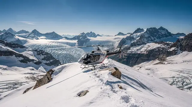
If that’s the plan, it’s worth booking before you arrive rather than hoping for a same-day slot: a picnic landing on the Franz Josef névé with helicopter transfers gets you onto the ice itself, while the Grand Tour by helicopter with a snow landing covers more of the glacier from the air. If Aoraki / Mount Cook is also on your route, the 55-minute Aoraki / Mount Cook glacier flight is worth comparing against the Franz Josef options for price and flight time.
All of these are weather-dependent, same as everything else in this part of the country — build in a spare day near the glaciers if you can, rather than scheduling a flight for your only afternoon. See our comparison of Franz Josef versus Fox Glacier and the fuller glacier heli-hike guide for how the flight options stack up, and our list of things to do around Franz Josef Glacier for what else fills a day there beyond the ice.
Should you drive it in a day, or break the journey?
Doing Queenstown to Franz Josef via Haast Pass in a single day is entirely possible — it’s one long day of driving with a handful of short stops, not a multi-day trek. Whether it’s worth it depends on how much you want to see once you get there. Arriving at 4pm after a 5-and-a-half-hour drive doesn’t leave much daylight for the glacier area, and flights over Franz Josef and Fox are weather-dependent, so a delayed or cancelled flight with no spare day can mean missing them altogether. Our four-day Queenstown to West Coast glaciers itinerary spreads the drive, an overnight, and a buffer day for weather across a more realistic timeframe.
Packing the car for a remote road
Because services thin out so quickly after Makarora, it pays to treat the drive as a small expedition rather than a commute. Put water and snacks within reach of the front seats, keep a rain layer on top of the luggage rather than at the bottom, and download your offline maps the night before, while the Wi-Fi in Wanaka is still reliable. A charged phone and a car charger matter more here than on most of the South Island, since coverage comes and goes. If you are comparing options for the vehicle itself, the car rental guide and the notes on buses and shuttles around the southern lakes will help you decide whether driving yourself is the right call for your group.
Making the most of the light
The pass rewards an early start. Leaving Wanaka in the morning gives you the best chance of reaching the waterfalls before the car parks fill up and well before the afternoon, when tiredness sets in on a winding road. The valley changes character as you go: open lake country first, then dense beech forest, then the wide gravel-bed river flats near the coast. Photographers will find plenty to work with, and our photography spots guide has ideas for composing shots in this kind of light. Build your stops around the daylight you have, not the other way round, and resist the urge to rush the last stretch towards the glaciers.
Who should skip it
Haast Pass is not for everyone. If you dislike long days behind the wheel, or if your group includes anyone prone to car sickness on bends, the drive can feel like more of a chore than a highlight. Travellers short on time may be better served by staying in the Queenstown area, where the best day trips from Queenstown offer plenty without a full day of driving. Those who only want a taste of the mountains and lakes could look at Lake Hawea or Wanaka as a lighter outing, and anyone heading the other way, to Mount Cook, will find the Queenstown to Mount Cook guide a better fit.
Combining the pass with a wider trip
Many visitors fold Haast Pass into a loop: south from Queenstown, over the pass to the coast, then north to the glaciers, before returning inland by another route. Our Queenstown to Christchurch routes guide and the four-day Queenstown to Christchurch itinerary show how the West Coast leg can fit into a longer crossing of the island. If you would rather keep a base and explore at a slower pace, the five-day Queenstown itinerary is a calmer alternative, and the first-time guide to Queenstown helps you weigh how much of the wider region to attempt on one visit.
Haast Pass and Tioripatea: frequently asked questions
Is there fuel between Wanaka and Haast?
There’s a fuel stop at Makarora, about 65 km north of Wanaka. After that there is no petrol station for 120 km, all the way to Haast township. Fill up at Wanaka or Makarora, not on the way past.
How long does the Haast Pass drive take from Queenstown?
Queenstown to Haast township is around 255 km and about 3 h 45 of driving. Continuing on to Franz Josef adds roughly another 95 km and 1 h 15, for a total of about 5 h 30 with a couple of short stops.
Do I need snow chains for Haast Pass in winter?
The pass itself sits at only 563 m, the lowest of the South Island’s main alpine crossings, so chains are less often required than on the Crown Range or Lindis Pass. Ice, slips and flooding still close the road at times in winter; check the New Zealand Transport Agency’s status page before you leave.
What does Tioripatea mean?
Tioripatea is the Ngāi Tahu name for the pass and is generally translated along the lines of “the way ahead is clear”. It marks a route Ngāi Tahu used long before 1965 to travel between Otago and the pounamu of the West Coast.
Are the sandflies at Haast Pass really that bad?
Yes, particularly at the waterfall car parks and anywhere near still water or bush shade. They’re at their worst in the warmer months and easing off the engine for two minutes is enough to pick up several bites. Keep repellent within reach, not in the boot.
Can Haast Pass be a day trip from Queenstown?
As a return day trip to Haast township and back, yes, but it makes for a long day behind the wheel — over 7 hours of driving alone. Most people use the pass as one leg of a longer trip to Franz Josef, Fox Glacier or further up the coast, rather than a there-and-back outing.
What’s the difference between Thunder Creek Falls and Fantail Falls?
Thunder Creek Falls drops about 28 m and is reached by a flat, well-formed track roughly 10 minutes return. Fantail Falls is a much shorter roadside stop, about 5 minutes return, with a wider, lower cascade you can walk right up to.
Is the Haast Pass road sealed the whole way?
Yes, State Highway 6 is fully sealed between Wanaka and Haast, including over the pass itself. It’s narrow and winding in places, with sections prone to slips after heavy rain, but it isn’t a gravel road.