The Hooker Valley Track, step by step
How hard is the Hooker Valley Track?
It is 10 km return (about 3 hours), crosses three swing bridges, and gains very little height, so it counts as easy by Aoraki Mount Cook standards. The real variable is wind: the valley funnels strong westerlies, and the swing bridges can be closed on the DOC's advice when gusts get dangerous.
What you are actually signing up for
The Hooker Valley Track is 10 km return, takes about 3 hours at an easy walking pace, and gains only around 100 metres over its whole length. That combination — real distance, almost no climbing — is unusual in the Aoraki Mount Cook area, where most other routes are steep from the first switchback. It is also the single most walked track in the national park, and on a clear summer morning the White Horse Hill car park fills early.
The track runs up the true right of the Hooker River, on a formed gravel and boardwalk surface, crossing three swing bridges before finishing at the shore of Hooker Lake, a glacial terminal lake with Aoraki/Mount Cook — 3,724 metres, the highest peak in the country — filling the head of the valley. There is no loop option: you walk out and back the same way, which at least means you know exactly what the return leg looks like before you commit to the outward one.
This guide covers the track section by section, what the three bridges are actually like to cross, why the wind matters more than the distance, when the light is worth getting up early for, and the two obvious alternatives nearby — Tasman Lake and Sealy Tarns — for anyone who wants a different view of the same glaciers without repeating the same path.
The three swing bridges, one at a time
First bridge, roughly 1.4 km in, crosses a side stream shortly after the track leaves the car park and climbs a short rise. It is the shortest and least exposed of the three, a reasonable place to judge whether the wind that day is a non-issue or something to take seriously before committing further.
Second bridge, around 4 km in, crosses the Hooker River itself on a longer span, with more sway and a clearer drop to the braided riverbed below. This is usually where people who are uneasy about the first bridge decide whether to continue.
Third bridge, close to 4.5 km in, is the longest of the three and the last obstacle before the final easy stretch to the lake. All three are standard DOC swing bridges — steel cable, wire mesh sides, wooden decking — built for foot traffic, not spectacle, but they move more than a fixed bridge and that unsettles some walkers more than the height does.
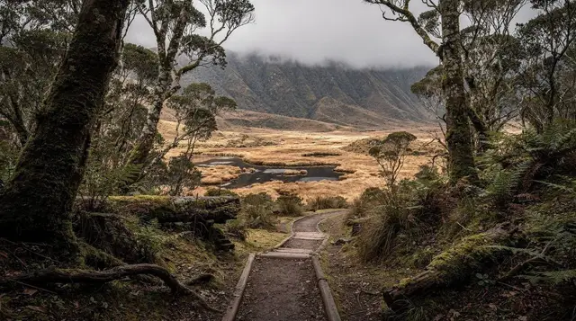
Between and after the bridges the track is unglamorous by design: gravel, some boardwalk over boggy sections, tussock and matagouri scrub, with Aoraki growing steadily larger ahead rather than appearing all at once.
The terminal lake and the icebergs
The track ends at Hooker Lake, formed as the Hooker Glacier has retreated and left a proglacial lake in its place — the same process, on a smaller scale, behind the Tasman Glacier’s own terminal lake further along the valley system. The water carries fine glacial sediment, giving it a pale grey-green colour rather than the turquoise seen at Lake Pukaki or Lake Tekapo downstream.
Small icebergs calve from the glacier face and drift across the lake, close enough to see clearly from the shore but far enough that no path continues around or onto the ice — this is a viewpoint, not a glacier walk. Their presence and size change week to week with recent calving, so treat photos you have seen online as indicative, not a promise of what you will find on the day. Aoraki/Mount Cook rises directly behind the lake, and on a clear, still morning this is the payoff for the flat 5 km walk in: a full, unobstructed view of the country’s highest mountain from its own glacial valley floor.
The trap: wind closes bridges, and it is not always forecast
This is the detail that catches people out. The Hooker Valley funnels the prevailing westerly wind, and gusts that would be a minor nuisance in open country become a genuine safety issue on a swaying, unenclosed bridge. The Department of Conservation closes individual bridges, or the entire track past a certain point, when conditions warrant it — and this decision is made on the day, based on actual gusts at the site, not on a general weather forecast checked from a phone the night before.
A calm morning forecast does not guarantee a calm valley by early afternoon, and a windy-looking forecast does not always mean closure. The only reliable source is the DOC visitor centre at Aoraki/Mount Cook Village, or the notice board at the White Horse Hill car park itself, checked on the morning you intend to walk. Build this into the plan rather than treating it as an afterthought: if the whole point of the drive from Queenstown is this specific walk, a five-minute stop at the visitor centre before heading to the car park is worth more than any weather app.
If the bridges are closed, the practical fallback is the first section of track before the closure point, or one of the nearby alternatives below that do not rely on the same crossings.
Best light, and the cold that comes with it
Early morning is the strongest case for this walk: calmer wind before the day’s heating gets going, softer light on Aoraki, and a car park that is not yet full. This holds for most of the year, though the trade-off shifts with season — in winter, an early start means walking the first stretch in the dark or in hard frost, with ice possible on boardwalk sections in shaded parts of the valley.
Afternoon brings warmer air but also the higher likelihood of the wind building, which is when bridge closures are most common. There is very little shelter along the entire route — no bush canopy, no built shelter beyond the car park itself — so temperature, wind, and UV exposure all matter more here than the modest distance suggests. Sun protection matters even on a cool day, given how clear and thin the air is at this elevation.
Getting there from Queenstown
Aoraki/Mount Cook sits 265 km from Queenstown, around 3 hours 30 minutes by road via Cromwell, the Lindis Pass, Omarama, and Twizel — a genuine day-trip distance, not a short detour, and one best treated the same way as a Milford Sound day out: an early start and a realistic view of how much daylight the return drive eats up.
Self-driving gives full control over timing, useful given the wind-dependent nature of the walk, but adds close to 7 hours of driving on top of the walk itself. An organised day trip removes that decision entirely.
a guided Hooker Valley Track day trip from Queenstown handles the return drive and builds in stops along the way, which suits anyone who would rather not do 7 hours behind the wheel either side of a 3-hour walk.
For a different way to see the glaciers of the same valley system without walking to them, a heli-hike onto the Tasman Glacier lands you on the ice itself by helicopter — a genuinely different experience from the Hooker Valley’s ground-level lake view, and one that does not depend on the swing bridges being open.
Travellers wanting a fuller day around Aoraki/Mount Cook rather than a single walk might look at a small-group Aoraki Ultimate tour, which combines several viewpoints and activities in the area into one guided day.
Nearby alternatives: Tasman Lake and Sealy Tarns
Tasman Lake sits further up the same road system, reached by a shorter walk from its own car park to a viewpoint over the terminal lake of the Tasman Glacier, the country’s longest at 23 km. The lake did not exist before the 1970s and has grown steadily since as the glacier has retreated — a useful comparison point to the Hooker Glacier’s own terminal lake, and a shorter outing for anyone with limited time or energy left after the Hooker walk.
Sealy Tarns is the harder option in the same valley system: a steep climb on the Mueller Hut route to a viewpoint over a set of small tarns, with Aoraki visible from height rather than from the valley floor. It is a different kind of walk entirely — real elevation gain on a formed but relentless staircase section — and not a fallback for a windy Hooker Valley day, since it is equally exposed and generally considered harder, not easier.
Either makes sense as a second walk on a multi-day stop in the area, rather than a same-day substitute if the Hooker bridges are closed and time is short.
Track summary
| Section | Distance from car park | Notes |
|---|---|---|
| White Horse Hill car park to Bridge 1 | 1.4 km | Gentle rise, shortest bridge |
| Bridge 1 to Bridge 2 | to ~4 km | Gravel track beside the Hooker River |
| Bridge 2 to Bridge 3 | to ~4.5 km | Longest, most exposed bridge |
| Bridge 3 to Hooker Lake | to 5 km | Flat finish, terminal lake and icebergs |
| Return | 5 km back | Same route, no loop |
| Option | Distance/time | Best for |
| Hooker Valley Track | 10 km return, ~3 hours | Ground-level lake view, three bridges, flat |
| Tasman Lake walk | Shorter, under 1 hour return | Quick terminal-lake view, less time available |
| Sealy Tarns | Steep, several hours return | Elevated views, fitness required, not a wind-day fallback |
| Heli-hike on Tasman Glacier | Half day, by helicopter | Walking on the ice itself, weather-dependent flying |
What to pack
Layers are the non-negotiable item, given how much the valley’s wind and temperature can shift between the car park and the lake, in either direction, at any time of year. A windproof outer layer matters more here than on many easier-rated walks, precisely because there is no bush cover for most of the route. Solid footwear handles the gravel and any icy boardwalk sections without trouble; there is no need for anything more technical than a sturdy walking shoe or light boot. Sun protection — hat, sunscreen, sunglasses — is worth taking seriously given the elevation and clear air, even under cloud. Carry your own water and food; there is nothing to buy past the White Horse Hill car park.
Related reading
For the broader picture of walking options around Queenstown and the Mackenzie Basin, see best hikes around Queenstown and great walks near Queenstown. For the drive itself, Queenstown to Mount Cook covers the route in more detail, and best day trips from Queenstown sets this walk alongside the other options for a single long day out. Anyone extending the trip toward the coast should look at the Queenstown to West Coast glaciers itinerary.
If the plan includes a night in the area, Lake Tekapo and the Mackenzie Dark Sky Reserve or stargazing Tekapo vs Queenstown are worth reading before booking, since the same clear valley air that makes the Hooker Valley Track scenic also makes this one of the best stargazing regions in the country. For what glossy brochure photos leave out about glaciers generally, see what the brochure doesn’t say about glaciers, and for a wider look at the area’s activities, things to do around Aoraki Mount Cook covers options beyond this one track.
Hooker Valley Track FAQs
How long does the Hooker Valley Track take?
Budget 3 hours return for the full 10 km, walking at an easy pace with stops at each bridge. Fit walkers move faster; families with small children or anyone stopping often for photos should allow closer to 3.5 hours.
Is the Hooker Valley Track flat?
Close to it. The track climbs gently in stages rather than steeply, gaining only around 100 metres over the whole 10 km, which is why it is rated easy rather than moderate. The surface is formed gravel and boardwalk, with the three swing bridges the only technical sections.
Do the swing bridges close in wind?
Yes, sometimes. The Department of Conservation closes individual bridges, or the whole track, when westerly gusts funnelling down the valley make the bridges unsafe to cross. There is no way to predict this from a forecast app alone — check at the White Horse Hill or Aoraki/Mount Cook Village visitor centre on the day.
Can you see icebergs on the Hooker Valley Track?
Usually, yes. Hooker Lake is a glacial terminal lake fed by the Hooker Glacier, and small icebergs calve off the glacier face and drift across the milky, sediment-grey water. Their number and size vary week to week, so it is never guaranteed, but it is the normal case rather than the exception.
What time of day is best for the Hooker Valley Track?
Early morning gives the calmest wind, the softest light on Aoraki/Mount Cook, and the fewest people at the car park. Afternoon wind tends to pick up as the day warms, which is also when bridge closures are most likely.
Where does the Hooker Valley Track start?
At the White Horse Hill car park, a few minutes’ drive past Aoraki/Mount Cook Village at the end of State Highway 80. There is a shelter, toilets, and track information at the car park, with the fuller DOC visitor centre back in the village.
Is the Hooker Valley Track suitable for kids?
Generally yes, given the flat grade and formed surface, and it is a common choice for families visiting Aoraki/Mount Cook. The swing bridges move underfoot and can unsettle younger children or anyone uneasy with heights, and there is no shelter from wind or sun for most of the route.
Guided walks & hikes on GetYourGuide
Verified deep-linked GetYourGuide tours. Book through these links and we earn a small commission at no cost to you.
GetYourGuide does not provide a product photo for this activity — the image shows the meeting point, photographed by us.